Mapas topográficos Tennessee
Haga clic en un mapa para ver su topografía, su altitud y su relieve.
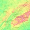
East Tennessee
East Tennessee occupies one of the most rugged and varied parts of the southern Appalachians, where the landscape steps from the deeply dissected Cumberland Plateau in the west into the long, parallel ridges and valleys of the Appalachian Valley and Ridge, then rises sharply into the Blue Ridge and Great Smoky…
Altitud media: 435 m




Roan Mountain State Park
United States > Tennessee > Carter County > Roan Mountain
Roan Mountain State Park hosts a variety of outdoor activities including hiking, mountain biking, camping, cross-country skiing (during snowy, winter months), fishing, and swimming. A heated swimming pool is open from Memorial Day to mid-August. At an elevation of 2,972 feet (906 m), the outdoor swimming pool…
Altitud media: 988 m


Great Smoky Mountains National Park
United States > Tennessee > Sevier County
Elevations in the park range from about 875 feet (267 m) to 6,643 feet (2,025 m) at the summit of Clingmans Dome. Within the park a total of sixteen mountains reach higher than 5,000 feet (1,520 m).
Altitud media: 765 m



Edwin Warner Park
United States > Tennessee > Davidson County > Nashville > Devonshire Manor
Altitud media: 198 m




Easton Terrace
United States > Tennessee > Hamilton County > Chattanooga > Red Bank
Altitud media: 240 m














Regency Place
United States > Tennessee > Hamilton County > Chattanooga > Ridgeside
Altitud media: 234 m


Dallas Crest
United States > Tennessee > Hamilton County > Chattanooga > Red Bank
Altitud media: 237 m