
Gracias por apoyar a este sitio ❤️
Haz una donación
Haz una donación
Mapa topográfico Crestone
Haga clic en el mapa para ver la altitud.
Gracias por apoyar a este sitio ❤️
Haz una donación
Haz una donación
Acerca de este mapa
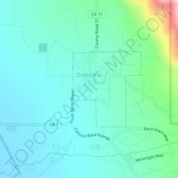
Nombre: Mapa topográfico Crestone, altitud, relieve.
Lugar: Crestone, Saguache County, Colorado, United States (37.98753 -105.70240 37.99896 -105.68913)
Altitud media: 2.444 m
Altitud mínima: 2.357 m
Altitud máxima: 2.842 m
Gracias por apoyar a este sitio ❤️
Haz una donación
Haz una donación
Otros mapas topográficos
Haga clic en un mapa para ver su topografía, su altitud y su relieve.
Crestone Peak
United States > Colorado > Saguache County
Generally climbs of Crestone Peak or Crestone Needle start from a base camp at South Colony Lakes, east of the peak, accessed from the Wet Mountain Valley on the northeast side of the range. This route involves nearly 6,000 ft (1,800 m) of elevation gain, and ascends to a large relatively flat area called "The…
Altitud media: 3.875 m
Gracias por apoyar a este sitio ❤️
Haz una donación
Haz una donación
Gracias por apoyar a este sitio ❤️
Haz una donación
Haz una donación