
Mapa topográfico Kalpetta
Mapa interactivo
Haga clic en el mapa para ver la altitud.
Kalpetta
Kalpetta is a major City, Town and municipality in the Wayanad district of the Indian state of Kerala. Kalpetta is the headquarters of Wayanad district, as well as the headquarters of Vythiri taluk. It is a bustling city, town surrounded by dense coffee and tea plantations and mountains. It lies on the Kozhikode-Mysore National Highway NH 766 (formerly NH 212) at an altitude of about 780 m above sea level. Kalpetta is 72 km from Kozhikode and 140 km from Mysore.
Acerca de este mapa
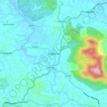
Nombre: Mapa topográfico Kalpetta, altitud, relieve.
Lugar: Kalpetta, Vythiri, Wayanad, Kerala, 673121, India (11.57028 76.04281 11.65028 76.12281)
Altitud media: 809 m
Altitud mínima: 722 m
Altitud máxima: 1.385 m