
Mapa topográfico Chihuahuan Desert
Mapa interactivo
Haga clic en el mapa para ver la altitud.
Chihuahuan Desert
There are several larger mountain ranges in the Chihuahan Desert, including the Sierra Madre, the Sierra del Carmen, the Organ Mountains, the Franklin Mountains, the Sacramento Mountains, the Chisos Mountains, the Guadalupe Mountains, and the Davis Mountains. These create "sky islands" of cooler, wetter, climates adjacent to, or within the desert, and such elevated areas have both coniferous and broadleaf woodlands, including forests along drainages and favored exposures. The lower elevations of the Sandia–Manzano Mountains, the Magdalena–San Mateo Mountains, and the Gila Region partly border the Chihuahuan Desert and partly border other ecoregions that are not deserts.
Acerca de este mapa
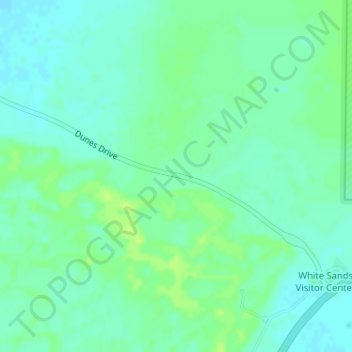
Nombre: Mapa topográfico Chihuahuan Desert, altitud, relieve.
Lugar: Chihuahuan Desert, Otero County, New Mexico, United States (32.78739 -106.18660 32.78749 -106.18650)
Altitud media: 1.221 m
Altitud mínima: 1.215 m
Altitud máxima: 1.228 m
Otros mapas topográficos
Haga clic en un mapa para ver su topografía, su altitud y su relieve.
Cloudcroft
United States > New Mexico > Otero County
Cloudcroft is a village in Otero County, New Mexico, United States, and is located within the Lincoln National Forest. The population was 674 at the 2010 census. Despite being located in an otherwise arid region, its high elevation (8,676 feet (2,644 m); one of the highest in the U.S.) allows for a mild summer…
Altitud media: 2.643 m
Alamogordo
United States > New Mexico > Otero County
As of 2010, Alamogordo had a total area of 19.3 square miles (50.0 km2), all of it land. The city is located at an elevation of 4,336 feet (1,322 m) on the western flank of the Sacramento Mountains and on the eastern edge of the Tularosa Basin. It lies within the Rio Grande rift and in the northernmost part of…
Altitud media: 1.427 m
Cloudcroft
United States > New Mexico > Otero County
Its high elevation of 8,676 feet (2,644 m) allows for a mild summer, and the forested mountains make it a tourist attraction for the surrounding deserts. Tourism is the primary economy of the village.
Altitud media: 2.643 m
White Sands National Park
United States > New Mexico > Otero County
The first US Army exploration of south-central New Mexico was led by a party of topographical engineering officers in 1849. They passed west of the San Andres Mountains and Organ Mountains. A lieutenant was dispatched east across the basin with a scouting party to map a potential military wagon route to the…
Altitud media: 1.214 m
Alamogordo
United States > New Mexico > Otero County
As of 2010, Alamogordo had a total area of 19.3 square miles (50.0 km2), all of it land. The city is located at an elevation of 4,336 feet (1,322 m) on the western flank of the Sacramento Mountains and on the eastern edge of the Tularosa Basin. It lies within the Rio Grande rift and in the northernmost part of…
Altitud media: 1.515 m
Cloudcroft
United States > New Mexico > Otero County
Cloudcroft is a village in Otero County, New Mexico, United States, and is located within the Lincoln National Forest. The population was 674 at the 2010 census. Despite being located in an otherwise arid region, its high elevation (8,676 feet (2,644 m) allows for a mild summer and forested surroundings that…
Altitud media: 2.643 m
Alamogordo
United States > New Mexico > Otero County
As of 2010, Alamogordo had a total area of 19.3 square miles (50.0 km2), all land. The city is located at an elevation of 4,330 feet (1,320 m) on the western flank of the Sacramento Mountains and on the eastern edge of the Tularosa Basin. It lies within the Rio Grande rift and in the northernmost part of the…
Altitud media: 1.427 m