
Mapa topográfico Gundagai
Mapa interactivo
Haga clic en el mapa para ver la altitud.
Gundagai
Gundagai is an inland town with an elevation of 250 metres (820 ft). Almost all of the shire is located in the South West Slopes bio-region and is part of the Riverina agricultural region. The eastern part of the shire is considered part of the South Eastern Highlands bioregion.
Acerca de este mapa
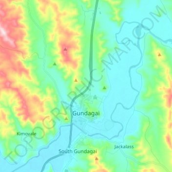
Nombre: Mapa topográfico Gundagai, altitud, relieve.
Altitud media: 309 m
Altitud mínima: 208 m
Altitud máxima: 622 m