
Haz una donación
Mapa topográfico Monarch Pass
Haga clic en el mapa para ver la altitud.
Haz una donación
Monarch Pass
Monarch Pass (elevation 11,312 feet (3,448 m)) is a high mountain pass in central Colorado, in the Rocky Mountains of the western United States.
Haz una donación
Acerca de este mapa
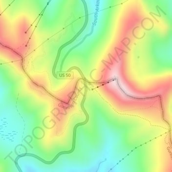
Nombre: Mapa topográfico Monarch Pass, altitud, relieve.
Lugar: Monarch Pass, Gunnison County, Colorado, United States (38.49638 -106.32616 38.49648 -106.32606)
Altitud media: 3.419 m
Altitud mínima: 3.245 m
Altitud máxima: 3.632 m
Haz una donación
Otros mapas topográficos
Haga clic en un mapa para ver su topografía, su altitud y su relieve.
Crested Butte
United States > Colorado > Gunnison County
At the 2020 United States Census, the town had a total area of 535 acres (2.166 km2), all of it land. Crested Butte lies at an elevation of 8,885 feet (2,708 m) above sea level.
Altitud media: 2.798 m
Crested Butte
United States > Colorado > Gunnison County
Crested Butte is located in north-central Gunnison County on the west side of the valley of the Slate River, along Coal Creek. Colorado State Highway 135 runs south from Crested Butte 27 miles (43 km) to Gunnison, the county seat. According to the United States Census Bureau, the town of Crested Butte has a…
Altitud media: 2.798 m
Haz una donación
Crested Butte
United States > Colorado > Gunnison County
At the 2020 United States census, the town had a total area of 535 acres (2.166 km2), all of it land. Crested Butte lies at an elevation of 8,885 feet (2,708 m) above sea level.
Altitud media: 2.798 m
Haz una donación