
Mapa topográfico Chautauqua Lake
Mapa interactivo
Haga clic en el mapa para ver la altitud.
Acerca de este mapa
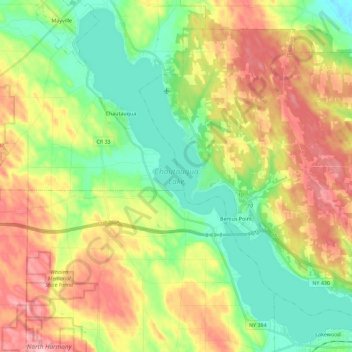
Nombre: Mapa topográfico Chautauqua Lake, altitud, relieve.
Altitud media: 463 m
Altitud mínima: 384 m
Altitud máxima: 575 m
Chautauqua Lake, at an elevation of 1,308 feet (399 m) above sea level, is higher than any of the Finger Lakes. It is also one of the highest navigable lakes in North America. The lake's water level is regulated by Warner Dam, with the water level lifted during the summer to allow for recreational boat use and lowered during the winter months.