
Haz una donación
Mapa topográfico Berwick
Haga clic en el mapa para ver la altitud.
Haz una donación
Berwick
According to the United States Census Bureau, the town has a total area of 37.86 square miles (98.06 km2), of which 37.52 square miles (97.18 km2) is land and 0.34 square miles (0.88 km2) is water. Berwick is drained by the Little River and Salmon Falls River. Diamond Hill, at an elevation of 490 feet (149.4 m) above sea level, is the town's highest point. The lowest elevation, which is approximately 70 feet (21.3 m) above sea level, is on the Salmon River as it crosses the southernmost town border with South Berwick.
Haz una donación
Acerca de este mapa
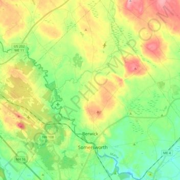
Nombre: Mapa topográfico Berwick, altitud, relieve.
Lugar: Berwick, York County, Maine, 03901, United States (43.23786 -70.92483 43.37245 -70.76040)
Altitud media: 76 m
Altitud mínima: 17 m
Altitud máxima: 165 m
Haz una donación