
Haz una donación
Mapa topográfico Trenta
Haga clic en el mapa para ver la altitud.
Haz una donación
Trenta
Trenta is a town high in the Crati river Valley. The town's ancient name, Triginta, derives from the Latin number triginta or thirty. Trenta was founded by Cosentine refugees in the 10th century AD, in the era of Saracen occupations of the nearby capital, Magli, which eventually became one of the administrative divisions that comprise the town of Trenta. The other divisions include Schiavonea, Feruci, Cribari, Catena, and Morelli. The town itself is made up of 4.65 square kilometers (1.80 sq mi), and sits at an altitude of over 600 meters above sea level.
Haz una donación
Acerca de este mapa
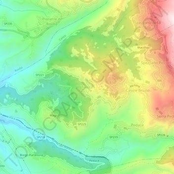
Nombre: Mapa topográfico Trenta, altitud, relieve.
Lugar: Trenta, Casali del Manco, Cosenza, Calabria, 87059, Italy (39.26509 16.30140 39.30509 16.34140)
Altitud media: 560 m
Altitud mínima: 315 m
Altitud máxima: 953 m
Haz una donación
Otros mapas topográficos
Haga clic en un mapa para ver su topografía, su altitud y su relieve.
Santa Domenica Talao
Vegetation includes Mediterranean scrub and olive groves at lower elevations, chestnut and oak woods on the hills, and mixed beech–silver fir stands at higher altitudes. Protected fauna in the Pollino National Park include roe deer, the Apennine wolf, golden eagle and several raptors.
Altitud media: 322 m
Haz una donación
Haz una donación
Lago
Lago is located in the mountainous interior of the Cosenza Province, near the slopes of Monte Cocuzzo. Despite being sited in mountainous territory, the higher elevations of the city offer views of the nearby coastline, including Stromboli. It regularly snows in Lago in the winter.
Altitud media: 760 m
Haz una donación
Haz una donación
Haz una donación
Haz una donación