
Gracias por apoyar a este sitio ❤️
Haz una donación
Haz una donación
Mapa topográfico Clever
Haga clic en el mapa para ver la altitud.
Gracias por apoyar a este sitio ❤️
Haz una donación
Haz una donación
Clever
Clever is located on the Springfield Plateau of the Missouri Ozarks, 14.5 miles (23.3 km) southwest of Springfield at an elevation of 1,398 feet (426 m). The town lies in the western panhandle of Christian County, just south of Missouri Highway 14 between Nixa and Billings. The town of Republic and the Wilson's Creek National Battlefield are approximately six miles to the north and northeast.
Gracias por apoyar a este sitio ❤️
Haz una donación
Haz una donación
Acerca de este mapa
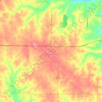
Nombre: Mapa topográfico Clever, altitud, relieve.
Lugar: Clever, Christian County, Missouri, United States (36.99394 -93.52779 37.07283 -93.41096)
Altitud media: 397 m
Altitud mínima: 338 m
Altitud máxima: 433 m
Gracias por apoyar a este sitio ❤️
Haz una donación
Haz una donación